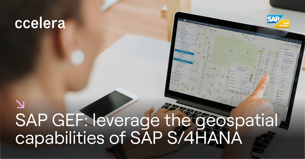
What is SAP GEF
SAP GEF is an advanced technology solution that enables companies to integrate and utilise geospatial data within their existing SAP environment. This platform provides powerful tools for managing, analysing and visualising geographical data in an intuitive way, enabling organisations to gain a deeper insight into their operations and activities. SAP GEF is a solution worth considering as part of a company’s transformation, as it offers numerous benefits.
The benefits of SAP GEF
In the previous paragraph it was noted how SAP GEF can offer several benefits to companies, so let’s take a look at the most important. First, its implementation will improve operational efficiency. By integrating geospatial data, companies can streamline operations, reduce travel times and optimise resources, improving overall efficiency.
Second, it will help the company to make informed decisions, this thanks to advanced geospatial analyses that enable data-driven decision-making, reducing risk and maximising the effectiveness of actions taken.
Third, it will increase customer engagement. How? SAP GEF makes it possible for companies to offer interactive and engaging customer experiences, providing detailed information on specific locations or services available in their area.
Last but not least, it will improve business agility. SAP GEF is designed to adapt to the needs of different industries, fostering the ability to react quickly to market changes.
What are the functions of SAP GEF
Now that we’ve seen the solution’s benefits, we’ll go into more specific detail on its functions. SAP GEF:
- Allows the integration of geospatial data from different sources, such as maps, satellite images and GPS data. This data can be correlated with existing business information to provide a comprehensive and contextualised view of company operations.
- It allows sophisticated geospatial analysis, such as real-time resource monitoring, route optimisation and service coverage mapping. These analyses help to identify trends, predict outcomes and make informed decisions.
- Another particularly interesting function is geospatial visualisation, which offers the possibility of visualising geographical data on interactive maps, making it easier to understand the information and identify any hidden relationships between the data.
- SAP GEF can support different industries: in fact it can be customised and configured for specific needs, allowing better integration with existing company processes.